Three Rivers, One Aquifer, and the Fight Over What Comes Out of Your Faucet
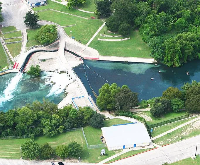
Photo: Comal River springs Texas clear water aerial Hill Country, via www.vacationsmadeeasy.com
If you've floated the Comal or Guadalupe this summer, you've enjoyed the end product of a complicated legal and geological machine. Every tube-rental shop, every subdivision, every backyard well in this county ultimately depends on the same underground plumbing — and right now, more people than ever are tapping it.
Here's what every Comal County resident should actually understand about where their water comes from and who's arguing about it.
The Plumbing Under Your Feet
The Edwards Aquifer is a massive limestone sponge stretching across Central Texas, and Comal County sits right over some of its most sensitive ground. Rain that falls on the recharge zone — parts of our county included — soaks through cracks in the rock and becomes drinking water for millions of people from San Antonio to the Hill Country.
Two rivers define us. The Guadalupe runs through the county on surface flows released from upstream reservoirs, managed under a different set of rules entirely. The Comal is different: it's fed almost entirely by spring flow from the aquifer itself. When aquifer levels drop, the Comal River literally slows down. That's not a metaphor — during the droughts of the 1950s and again in the 2010s, spring flows fell low enough to trigger restrictions.
The Hays County line to our north matters too, because growth pressures in that corridor share the same aquifer systems. Water doesn't respect county lines; policies have to chase it.
The Rules That Shape Your Summer
Here's the part most newcomers don't know: the Edwards Aquifer Authority regulates pumping with a permit system, and during drought stages, permitted users — including major municipal suppliers — face mandatory cutbacks. Spring flow targets are the trigger. When flows at the Comal springs drop below set thresholds, the state's drought plan kicks in and everyone with a permit feels it.
Why does this matter to a homeowner? Three concrete ways:
- Your utility bill. Water providers pass along conservation pricing and infrastructure costs. Stage restrictions mean higher rates for heavy use.
- Your well. Rural residents on private wells draw from the same aquifer (or the shallower Trinity formations to the north). More pumping nearby can mean lower water tables and, in some areas, declining water quality as shallower zones get drawn down.
- Your weekends. The tubing economy is a spring-flow business. Low flows mean shorter floats, occasional closures on the Comal, and real revenue losses for rental outfitters, restaurants, and hotels that depend on river traffic.
Development Pressure Meets a Finite Sponge
Comal County has been one of the fastest-growing counties in the nation for years, and every new roof adds demand. The tension is straightforward: conservation groups and spring-flow advocates push for pumping limits and recharge protection, while developers and growing utilities need certainty that water will be there.
Local officials generally land in the middle — supporting growth while pointing to the regulatory framework as the guardrail. The Edwards Aquifer Authority's permits, the state's Edwards Aquifer Habitat Conservation Plan, and city-level drought ordinances form a layered system that, so far, has kept the springs flowing even through punishing droughts. Critics argue it's a managed decline; defenders call it one of the more successful water-sharing agreements in the West. Both have a point.
What conservation groups consistently emphasize: what happens on the land matters as much as how much gets pumped. Paving over recharge zones means less water makes it into the aquifer. That's why development decisions in western Comal County show up in water policy meetings — they're the same conversation.
What You Can Actually Do
You don't need to become a water-policy wonk. But three practical moves pay off:
- Know your source. City of New Braunfels water comes largely from the Edwards (with Trinity backup expanding). Rural well owners should test annually and know their well's depth and formation.
- Watch the drought stage, not the weather. Local restriction stages are announced based on aquifer levels and spring flows — that's the number that determines your watering schedule and your surcharge risk.
- Show up. The Edwards Aquifer Authority, city council, and county commissioners' court all take up water decisions. Public comment genuinely shapes permit and land-use outcomes here.
The bottom line: in Comal County, water policy isn't an abstraction happening in a hearing room. It's the height of the river in July, the number on your August bill, and whether your well holds through the next dry spell. The same water floating your tube this weekend has to come out of someone's faucet next summer. The county's whole economy — and its whole character — depends on keeping that balance.